CONSTRUCTION SITE MAPPING & PROGRESS
Accurate Drone Mapping for Construction Sites
Capture 2D and 3D models, monitor progress, and document every phase of your job site with scalable drone mapping.
Our orthomosaic and topographic maps help validate grades, measure stockpiles, and generate cut/fill reports—improving team coordination and reducing time on site.
Features:
Drone & elevation models
Topographic surveys
Progress documentation
Volumetrics & 3D modeling
Orthomosaic maps
Export files: PDF, GeoTIFF, .DXF, point clouds
Cut/fill analysis & grade verification
Hard-to-access area mapping
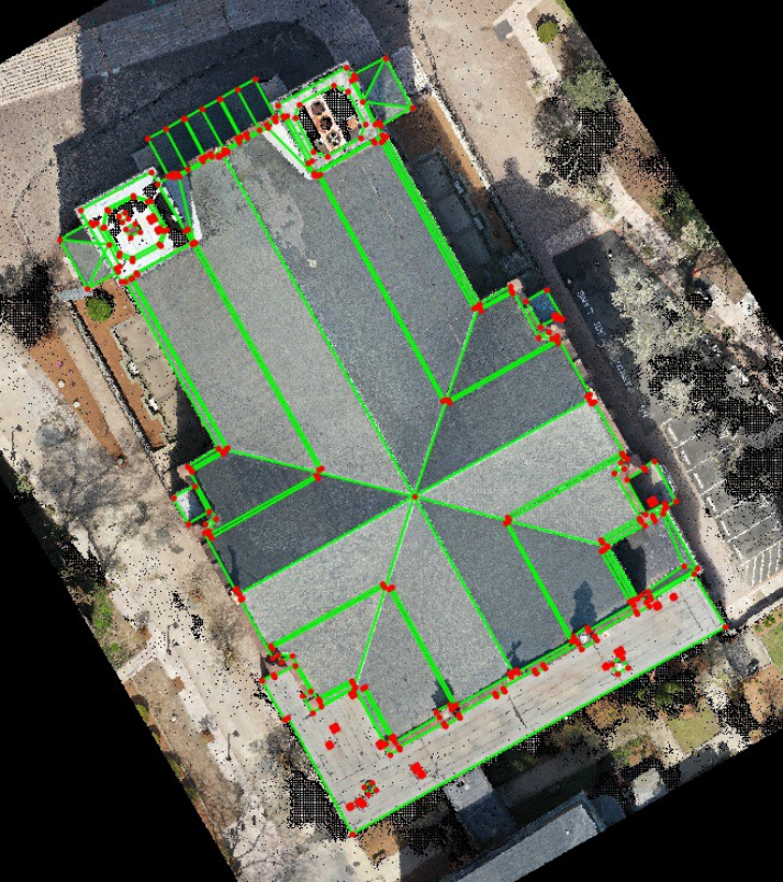
Detailed Drone Roof Reports Without Setting Foot on the Roof
Capture accurate measurements for pre-bid evaluations, insurance documentation, and maintenance planning.
Our drone-generated reports document every edge, penetration, slope, and obstruction—quickly and safely.
Services Include:
2D and 3D roof models
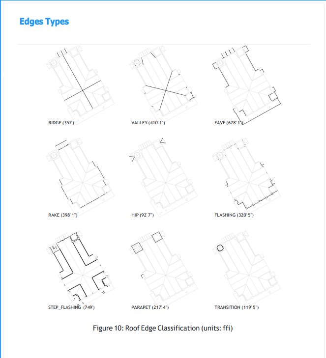
Edge type measurement (eaves, valleys, ridges, etc.)
Obstruction mapping (HVAC, vents, solar)
Export-ready files (.DXF, PDF)


SEE IT BETTER.
Ready to make smarter decisions with faster, clearer data from above?